Stel een vraag
Met het formulier hier onder kunt u contact op nemen met boekwinkel hasselman.
Schilder, Günther - Monumenta Cartographica Neerlandica V
De vraag gaat over de volgende titel:
| Afbeelding: |

|
|---|---|
| Schrijver: | Schilder, Günther |
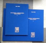
| Titel: | Monumenta Cartographica Neerlandica V |
| ISBN: | 9789064697043 |
| Uitgever: | "Canaletto" Alphen aan den Rijn 1996 9064697043 (Ned/Engels) |
| Bijzonderheid: | geb. hardcover in blauw linnen met goudopdruk 384pp + bijbehorende map met 142 facsimiles zie info |
| Prijs: |
€ 146,80
€ 3,65
|
| Meer info | Monumenta Cartographica Neerlandica V (1996) Ten wall maps by Blaeu and Visscher Consists of descriptions and facsimiles of ten wall maps; the four continents by Willem Blaeu (1624 state by Henricus Hondius); Germania by Willem Jansz. Blaeu and Nicolaas Visscher; Holland and West Friesland by Willem Blaeu (1621) and Nicolaas Visscher (s.d.); Italy by Willem Jansz. Blaeu (1614-1617); and Flanders by Willem Jansz. Blaeu, 1638. A description of the Amsterdam cartographic scene in the first half of the 17th century. The history of each copperplate in its different states is fully described and a full bibliography and list of extant examples or impressions provided for each item. Contents of Volume V I. The world opened up II. Wall maps of the four continents by Willem Jansz. Blaeu (1608) 1. Engraved allegorical representations of the four continents 2. Sets of wall maps of the continents, published in the Netherlands before 1608 3. Wall maps of the four continents by Willem Jansz. [Blaeu] published in 1608 and later III. The wall maps of Germania by the Visscher and Blaeu families 1. Wall maps of Germania published in the Southern Netherlands 2. The wall map of Germania by Rumold Mercator (1590) and its later versions by the Hondius and Visscher families 3. Pieter van den Keere's imitation of 1611 and its later versions. 4. The Germania wall map of 1612 by Willem Jansz. [Blaeu] and its later states IV. Wall maps of the Province of Holland and West-Friesland published by Willem Jansz. Blaeu and the Visscher family 1. The wall map of Holland by the Van Berckenrode family 2. The publication by Willem Jansz. Blaeu in 1621 3. A copy by Henricus Hondius, 1629 4. The Van Berckenrode/Blaeu map in the editions of the Visscher family V. Wall map of Italy by Willem Jansz. Blaeu 1. Giovanni Antonio Magini: The L'Italia atlas and his Italia Nuova wall map (1608) 2. The wall map of Italy by Willem Jansz. [Blaeu] [1614-17] VI. The wall map of Flanders by Willem Jansz. Blaeu, 1638 1. Forerunners. 2. The wall mp of Flanders by Willem Jansz. Blaeu, 1638 FACSIMILES 1. Willem Jansz. Blaeu, Wall map of Europe (1608) published by Henricus Hondius in 1624 (14 sheets) 2. Willem Jansz. Blaeu, Wall map of Asia (1608) published by Henricus Hondius in 1624 (14 sheets) 3. Willem Jansz. Blaeu, Wall map of Africa (1608) published by Henricus Hondius in 1624 (14 sheets) 4. Willem Jansz. Blaeu, Wall map of America (1608) published by Henricus Hondius in 1624 (14 sheets) 5. Nicolaas Visscher, Wall map of Germania [s.d.] (16 sheets) 6. Willem Jansz. Blaeu, Wall map of Germania (1612; 2nd state) (16 sheets) 7. Willem Jansz. Blaeu, Wall map of Holland and West-Friesland (1621) (11 sheets) 8. Nicolaas Visscher, Wall map of Holland and West-Friesland [s.d.] (18 sheets) 9. Willem Jansz. Blaeu, Wall map of Italy [1614-17] (16 sheets) 10. Willem Jansz. Blaeu, Wall map of Flanders (1638) (9 sheets) |
| Boek bekijken | |
![]()
Levering binnen de EU is mogelijk bij bestellingen vanaf 15 euro plus bijkomende internationale verzendkosten.
Afhalen is niet mogelijk.
De verkoper zal binnen 7 werkdagen contact met u opnemen om de koop verder af te handelen.
