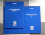
Schilder, Günther - Monumenta Cartographica Neerlandica II
| Schrijver: | Schilder, Günther |
|---|---|
| Titel: | Monumenta Cartographica Neerlandica II |
| Taal: | Meertalig |
| Uitgever: | "Canaletto" Alphen aan den Rijn 3e druk 1997 9064695773 (Ned/Engels) |
| Bijzonderheden: | geb. hardcover in blauw linnen met goudopdruk 171pp + bijbehorende map met 42 facsimiles zie info |
| Prijs: | € 101,80 |
| Verzendkosten: | € 3,65 (binnen Nederland) |
| Meer info: |
Monumenta Cartographica Neerlandica II (1987)
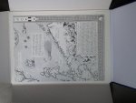
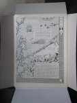
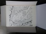
The second volume-in contrast is much more varied in content. It focuses mainly on sixteenth-century Antwerp, until its fall in 1585 the center of the Netherlands map trade. The volume reproduces in full size maps by Abraham Ortelius, Joan Baptista Vrients. and the Galle family. Three of Ortelius's wall maps are given chapters of their own, and the description of his wall map of the world (1564) is preceded by a description of other wall maps published before his time and outside the Netherlands. beginning with Waldseemuller (1507). Although it is not entirely clear why these non-Dutch maps were included (and the practice was not fully followed in later volumes). they are useful summary descriptions. In chapter two of the second volume, Schilder explains the relationship between some maps of Ortelius and the Italian geographer Giacomo Castaldi and here a little Dutch-Italian rivalry rears its head. For example, Ortelius's eight-sheet wall map of Asia in eight sheets (1567) was significantly based on Gastaldi's 'prima, seconda. e terza parte dell'Asia.' In fact, Ortelius acknowledges his debt to Gastaldi in his the address to the geography of Aboulfeda, which had become known in Europe through the infamous philologist. historian, and arabist Guillaume Postel (1495-1581). Postel gave his translated summary to Giambattista Ramusio, who published it in his Navigotioni et Vioggi. a work in which Gastaldi took part. But since there was no mention of a 'map' in Ramusio's summary of Aboulfeda - a 'model' is the word he uses one might wish for more discussion of the extent to which Gastaldi was indebted to the Arabic geographer for his information and whether or not there was an Arabic map on which he relied. In contrast. Schilder's analysis of Ortelius's six-sheet wall map of Spain (1571) and its related precursors is extremely thorough. Ortelius co authored this map with Carolus Clusius, whose travels in Spain to describe botanical specimens gave rise to his famous book on the plants of the Iberian peninsula (1576). Along the way. Clusius noted the landscape in general. and this information culminated in his contribution to Ortelius's wall map Among the useful descriptions of earlier wall maps of Spain is that concerning the curious four-sheet anonymous map in the Museo Correr and the map of Spain in six sheets (1558) attributed to Matteo Pagano by his imprint and dedicated - as are several Italian maps - to the Dutch humanist Nicholas Stopius. Contents of Volume II Introduction I. The map of the world by Abraham Ortelius, 1564 a. The world of Abraham Ortelius b. Printed wall-maps of the world published before 1564 c. The wall-map of the world in eight sheets by Abraham Ortelius, 1564 d. The folio edition of 1571 II. The wall-map of Asia by Abraham Ortelius, 1567 III. The wall-map of Spain by Abraham Ortelius and Carolus~Clusius, 1571 a. Carolus Clusius b. Wall-maps of Spain prior to 1570 c. The wall-map of Spain by Carolus Clusius IV. The wall-map of the Seventeen Provinces in twelve sheets by Joan Baptista Vrients, 1605 a. The editlo princeps by Filips Galle b. The edition by Joan Baptista Vrients, 1605 c. The edition by Joannes Galle d. A map of the Central Netherlands in two sheets, published by the Galle family FACSIMILES 1 Abraham Ortelius (8 sheets) 1. Abraham Ortelius, Wall-map of the world, 1564. (8 sheets) 2. Gerard de Jode, Map of the world, 1571. (1 sheet) 3. Abraham Ortelius, Wall-map of Asia, 1567. (8 sheets) 4. Abraham Ortelius - Carolus Clusius, Wall-map of Spain, 1571. (6 sheets) 5. Filips Galle - Joan Baptista Vrients, Wall-map of the Seventeen Provinces, 1605. (16 sheets) 6. Joannes Galle, Map of the Central Netherlands in two sheets. (3 sheets) 7. Filips Galle - Joan Baptista Vrients, Map of the Seventeen Provinces in folio, 1606. (1 sheet) 8. Joannes en Baptista van Deutecum, Map of the Seventeen Provinces in folio, 1588. (1 sheet) 9. Frederick de Wit, Map of the Seventeen Provinces in folio, 1652. (1 sheet) Monumenta Cartographica Neerlandica III (1990) Two wall-maps of the world by Blaeu: 1619 and 1645/56 Is larger than volumes I and II combined. It is devoted entirely to the wall map of the world in two hemispheres published in 1619 by Willem Jansz, Blaeu and reissued with alterations by his son Joan in 1645-46. Both versions are part of a rich cartographic tradition in Amsterdam in the first half of the seventeenth century that satisfied an immense demand for global information Testimony to the fragility of wall maps, thousands of impressions of both maps were originally printed but only one example of each state is extant, both at the 'Prins Hendrik' Maritime Museum in Rotterdam. Following the fall of Antwerp in 1585, the economic center of the Netherlands moved to the northern Netherlands, particularly Amsterdam Amsterdam's growth was stimulated by several factors: to record exploration associated with the northeast passage, the East and West Indies, and South America; to disseminate news of the war with Spain; and to document changes in the domestic cultural landscape, particularly hydrographical. To achieve these aims, the city was able to capitalize on the new pool of geographical talent in the form of religious refugees from the southern Netherlands, particularly Cornelis Claesz, Petrus Plancius, Petrus Bertius, and Pieter and Abraham Coos. With this backdrop in place, Schilder provides a short but very useful biography of Blaeu, who started out as Willem Jansz. but decided to adopt his father's sobriquet (Blue Willem) as the family name to avoid confusion with Jan Jansz. who had moved in next door, Willem Jansz. thus became Willem Jansz, Blaeu around 1622. Blaeu's appointment as official mapmaker to the Dutch East India Company (VOC) on the death of Hessel Gerritsz in 1632 sharpened his competitive edge: he now had the complete archive of maps and charts of the VOC at his disposal. But his competitors were never entirely As further background. this volume contains a description of thirteen wall maps of the world published in Amsterdam before 1619 with all their editions, highlighting the importance of the radical Calvinist Petrus Plancius's map of 1592 in eighteen sheets. Plancius's map was the basis of many Late sixteenth-century wall maps - Dutch and Italian - and Schilder provides a very useful genealogical stemma of its influence. The core of this third volume is a detailed description of the two versions of the Blaeu wall map (1619 and 1645/46). Sources used for iconography as well as geography are presented. Between Willem Blaeu's version of 1619 and Joan Blaeu's second edition (1645/46). there were key discoveries and advances in geographical knowledge: the fictitious northwest coast of America is omitted, and the results of Abel Tasman's two voyages (1642-43 and 1644) in Australia and New Zealand - as well as those of his predecessors - have been included. But not all the geographical changes to the map were 'progressive:' the representation of California as an island in the second version appears alongside the more timely representation of the momentous explorations in the southern hemisphere. Nor should the power of decoration in the market place he underemphasized. as Schilder's lengthy general excursion into the development of decorative borders on Dutch wall maps before 1619 demonstrates: after the Peace of Munster, which ended the Thirty Years' War and changed many national boundaries and names, Joan Blaeu put out an entirely new map of the world on 21 copper plates in 1648, but demand for the geographically obsolete 1645-46 map continued simply because the 1648 map did not have decorative borders. |
![]()
Levering binnen de EU is mogelijk bij bestellingen vanaf 15 euro plus bijkomende internationale verzendkosten.
Afhalen is niet mogelijk.
De verkoper zal binnen 7 werkdagen contact met u opnemen om de koop verder af te handelen.
Het huisnummer is ook opgegeven in het straat veld. Gelieve controleren of de velden straat en huisnummer correct zijn opgegeven.
Straat:
Nummer:
- Alle boeken zijn compleet en verkeren in normale antiquarische staat, tenzij anders beschreven. Kleine onvolkomenheden, zoals een ingeplakte ex-libris of een naam op het schutblad, zijn niet altijd vermeld
- U handelt deze order direct af met hasselman
Dit boekwinkeltje is een zakelijke verkoper. Hierdoor heeft u o.a. herroepingsrecht waarmee u het boek binnen 14 dagen na ontvangst retour kunt sturen. Verder lezen. - Identiteit verkoper:
Hasselman
Kamer van Koophandel nummer: 51639181
NL139540805B02
- Na uw bestelling ontvangen u en hasselman een bevestiging per e-mail. In de e-mail staan de naam, adres, woonplaats en telefoonnummer van hasselman vermeld
- De Koper betaalt de verzendkosten, tenzij anders overeen gekomen
- hasselman kan betaling vooraf vragen
- Boekwinkeltjes.nl probeert Kopers en Verkopers tot elkaar te brengen. Boekwinkeltjes.nl is echter nimmer partij bij een overeenkomst die gesloten wordt tussen Koper en Verkoper door gebruikmaking van de site. Als u een geschil hebt met één of meer gebruikers, dient u dit zelf op te lossen. U vrijwaart Boekwinkeltjes.nl van enigerlei vorderingen, aanspraken op schadevergoeding en dergelijke, verband houdende met dergelijke geschillen.
Onthoud mijn gegevens
Registreer u vrijblijvend als koper!
Besteld, hoe nu verder?
De verkoper zal binnen 7 werkdagen contact met u opnemen om de koop verder af te handelen. Afhankelijk van uw locatie heeft u in de meeste gevallen binnen 2 dagen uw bestelling in huis.

