Stel een vraag
Met het formulier hier onder kunt u contact op nemen met boekwinkel hasselman.
Schilder, Günther - Monumenta Cartographica Neerlandica VIII
De vraag gaat over de volgende titel:
| Afbeelding: |

|
|---|---|
| Schrijver: | Schilder, Günther |
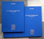
| Titel: | Monumenta Cartographica Neerlandica VIII |
| ISBN: | 9789064698330 |
| Uitgever: | "Canaletto" Alphen aan den Rijn 2007 9789064698330 (Ned/Engels) |
| Bijzonderheid: | geb. hardcover in blauw linnen met goudopdruk 595pp + bijbehorende map met 93 facsimiles zie info |
| Prijs: |
€ 400,90
€ 3,65
|
| Meer info | The maps and charts, published separately by Jodocus Hondius (1653-1612) and Petrus Kaerius (Pieter van den Keere) (1571-after 1646) are the subject of this volume. Both were renowned engravers, mapmakers and publishers, who had a decisive influence on development of cartography in Amsterdam. Their lives and cartographic works have been discussed in detail. A selection of the maps have been reproduced at full scale. From Hondius' production, e.g. a hitherto unknown eight-sheet wall map of the world on Mercator's projection (1596), the wall maps of the continents (1598), France (c. 1600), the British Isles (1604) and the Seventeen Provinces (1593 and 1602). From Kaerius' hand, e.g. the wall map of the world in four sheets (1609), the Seventeen Provinces of 1607 (1612) in twelve sheets and of Germania (1611) in seven sheets. Also an illustrated cartobibliography of Kaerius' separately folio-sized maps has been published in an appendix. Text volume 596 pp. and 960 figs. Map volume: 37 maps in 93 sheets. ISBN 978 90 6469 833 0 The maps and charts, published separately by Jodocus Hondius (1653-1612) and Petrus Kaerius (Pieter van den Keere) (1571-after 1646) are the subject of this volume. Both were renowned engravers, mapmakers and publishers, who had a decisive influence on development of cartography in Amsterdam. Their lives and cartographic works have been discussed in detail. A selection of the maps have been reproduced at full scale. From Hondius' production, e.g. a hitherto unknown eight-sheet wall map of the world on Mercator's projection (1596), the wall maps of the continents (1598), France (c. 1600), the British Isles (1604) and the Seventeen Provinces (1593 and 1602). From Kaerius' hand, e.g. the wall map of the world in four sheets (1609), the Seventeen Provinces of 1607 (1612) in twelve sheets and of Germania (1611) in seven sheets. Also an illustrated cartobibliography of Kaerius' separately folio-sized maps has been published in an appendix. |
| Boek bekijken | |
![]()
Levering binnen de EU is mogelijk bij bestellingen vanaf 15 euro plus bijkomende internationale verzendkosten.
Afhalen is niet mogelijk.
De verkoper zal binnen 7 werkdagen contact met u opnemen om de koop verder af te handelen.
